


Windsor Twp. Voting District, Traverse County, Minnesota
About
Outline
Summary
| Unique Area Identifier | 604682 |
| Name | Windsor Twp. Voting District |
| County | Traverse County |
| State | Minnesota |
| Area (square miles) | 21.76 |
| Land Area (square miles) | 15.60 |
| Water Area (square miles) | 6.16 |
| % of Land Area | 71.70 |
| % of Water Area | 28.30 |
| Latitude of the Internal Point | 45.69796580 |
| Longtitude of the Internal Point | -96.68952310 |
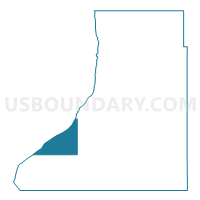
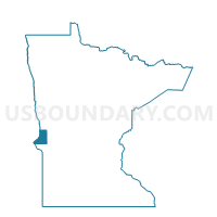
Maps

Graphs
Select a template below for downloading or customizing gragh for Windsor Twp. Voting District, Traverse County, Minnesota


Neighbors
Neighoring Voting District (by Name) Neighboring Voting District on the Map
- Arthur Twp. Voting District, Traverse County, MN
- Folsom Twp. Voting District, Traverse County, MN
- Lake Valley Twp. Voting District, Traverse County, MN
- Parnell Twp. Voting District, Traverse County, MN
- VTD - precinct 6 HarmonTwp-RosholtTown, Roberts County, SD
- VTD - precinct 7 Victor-Brnt-WhiteRockTwps-WhitRckTown, Roberts County, SD
- Walls Twp. Voting District, Traverse County, MN
Top 10 Neighboring County Subdivision (by Population) Neighboring County Subdivision on the Map
- Bryant township, Roberts County, SD (318)
- Lake Valley township, Traverse County, MN (237)
- Harmon township, Roberts County, SD (151)
- Folsom township, Traverse County, MN (128)
- Arthur township, Traverse County, MN (81)
- Windsor township, Traverse County, MN (66)
- Walls township, Traverse County, MN (65)
- Parnell township, Traverse County, MN (60)
Top 10 Neighboring Unified School District (by Population) Neighboring Unified School District on the Map
- Sisseton School District 54-2, SD (7,853)
- Wheaton Area School Public School District, MN (2,186)
- Rosholt School District 54-4, SD (1,028)
- Browns Valley Public School District, MN (799)